Land Use Range Program gives update

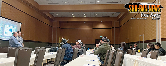
Land Range Update on December 10 at the Sho-Ban Event Center.
By BREE BAKER
Sho-Ban News
FORT HALL — On December 10, the Land Use Range Program had a Range Inventory update at the Shoshone-Bannock Event Center for permittees.
There was a presentation and discussion to follow. Range Management consultants Jack Alexander and Eric Sant presented their data collection. Topics ranged from grazing maps, concerns of the overtaking of weeds, questions of the number of wildlife, a possible extension of the current bid, and possible solutions on the land.
Mission statements from the Land Use Department and Tribal Range Program are “The mission of the Land Use Department is to enhance the quality of life, promote economic opportunity, and to carry out the responsibility to protect and improve the natural resources of the Shoshone-Bannock Tribes of the Fort Hall Reservation. We will accomplish this through the delivery of quality management services for our Tribal natural resources, regulating and enforcing the Land Use Ordinance, and continuing to work cooperatively with federal agencies in the spirit of self-determination to maintain Tribal Jurisdiction.” The mission of the Tribal Range Program is to effectively manage the Tribes’ rangeland for the best interest of the Shoshone-Bannock Tribes, its members, the landowners and the Permittees contacting use of the rangelands. Approximately 32,000 acres of Tribal Trust lands between Range Units 23, 26, and 28 are enrolled in the Conservation Reserve Program (CRP) Grasslands Program. Some information found during the 2024 Fiscal Year for the Range Program’s services and projects shows there are 320,033.99 total acres permitted on the range, 193,974.59 acres of Tribal Trust Lands, and 126,059.40 acres of allotted lands. There are 63 total permits for the 2024 grazing season, 32 are tribal members and 31 are non-members. 59 of the 63 permits were at a full stocking capacity, the other four permits have been deferred or contracted for different programs to use such as rangeland rest and rehabilitation, fish and wildlife and big game, as well as the buffalo program. There has been 7.5 miles fenced, new fences, repairs, and removal. A total of 64 solar panels have also been used to adequate water for livestock and wildlife.
On the agenda was a presentation of 2024 rangeland and riparian data collection, a review of initial analysis of field data, a presentation of updated grazing resources maps, review of maps with grazers and land users, and a discussion of current issues and potential solutions and improvements. The presenters were Jack Alexander, a certified range management consultant with Synergy Resource Solutions Inc. and Eric Sant, a geospatial analyst with Open Range Consulting. They presented their data collection from rangeland, they shared how they can map cheatgrass specifically and shared the grazing patterns in certain areas.
After their presentation, they opened the discussion for questions, concerns, and possible solutions. Attendees voiced concerns about the overtaking of weeds and the possibility of spot spraying, concerns about wildlife such as elk and beaver on the reservation, questions about cattle, and questions about the financial aspect of everything. When asked when they would have the final analysis, Alexander shared that they will have it around this time next year.


