Indian Rocks new interpretive signs tell Sho-Ban history in area
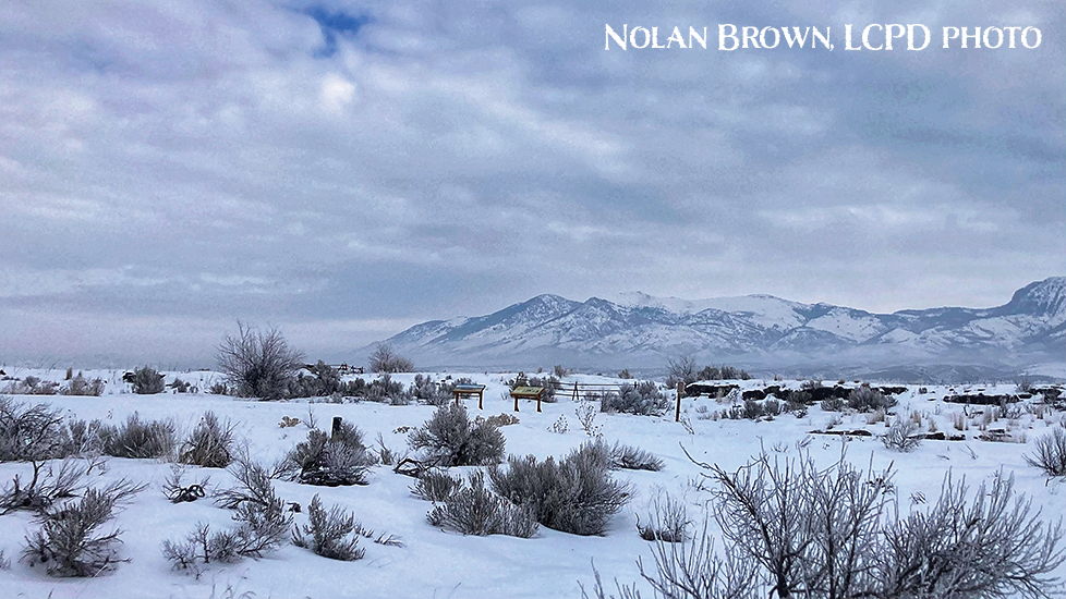
Indian Rocks interpretive sign site.
By ROSELYNN YAZZIE
Sho-Ban News
MCCAMMON — The Shoshone-Bannock Tribes Language and Culture Preservation Department collaborated with the BLM Idaho Falls District staff from the Pocatello Field Office to design two new interpretive signs installed at Indian Rocks near the petroglyph boulder display.
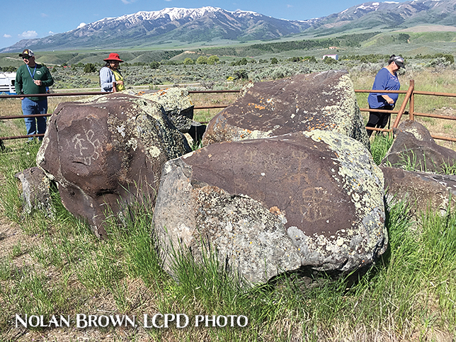
The site is designated an Area of Critical Environmental Concern (ACEC) to protect significant Native American cultural resources including petroglyphs and lithic scatters.
Language and Culture Preservation Original Territories & Historical Research Researcher Nolan Brown explained they started work on the signs on June 4, 2019 with a site visit to Indian Rocks, ACEC by BLM Pocatello Field Office staff including archaeologist Amy Lapp and Shoshone-Bannock HeTO and OTHR staff.
According to a press release, “The new signs help tell the story of the area and highlight the importance of its history and current features. One wayside details the petroglyphs and the importance of archaeological and cultural resources. The other provides information about the of Pihaguyu Nahuukwa Teviwa (the local Portneuf River Country), the creation of the Fort Hall Reservation, and traditional foods used by the Tribes today.
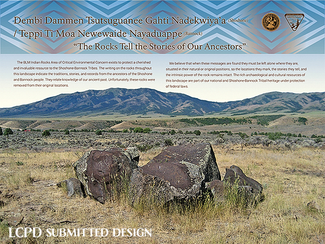
"The Rocks Tell Stories of Our Ancestors" sign design.
Brown said, “It is necessary to interpret tribal historical and cultural sites in our own words for the education of our tribal members and for the public. We want the whole landscapes, our memories, and our knowledge of our original territories and significant places of our history to endure. Just a couple features of this particular site are that it is located in the center of our original reservation boundaries and contains many irreplaceable cultural features such as the rock writings known as petroglyphs and pictographs, and other natural resources like genga (Shoshone) / keka (Bannock) wild onion species.”
Furthermore, Brown said it's a Fort Hall Business Council directive and the goal of the Sho-Ban Tribes Original Territories and Historic Research Office to document all historical and cultural sites and make necessary steps to preserve these places and resources. Where it’s appropriate we will use federal, state and local laws and work cooperatively with administrators of federal and other lands to assist in the designation of our historical and cultural sites.
Tribal staff visit Indian Rocks.
“This is a wonderful collaboration that shares a more complete view of the history and importance of these lands,” said Idaho Falls District Manager Mary D’Aversa. “The signs invite people to immerse themselves in the landscape and develop for a fuller appreciation and greater understanding of the area.”
There are many stories to explore in the area from the dark basalt cliffs formed as lava flowed from the Blackfoot Lava Field north and west of the site to the basalt boulders washed downstream and rounded by a catastrophic flood about 13,500 years ago that became the petroglyph rocks. They are some of the many “melon” boulders deposited across Idaho by what is called the Bonneville Flood. Indigenous people, living in southern Idaho at that time, probably witnessed and/or experienced this massive flood.
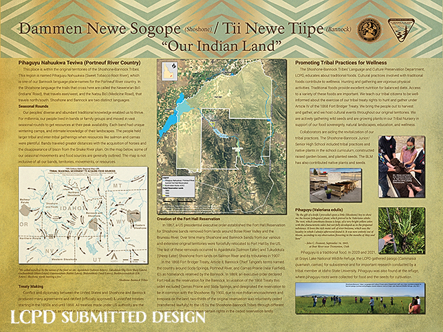
"Our Indian Lang" sign.